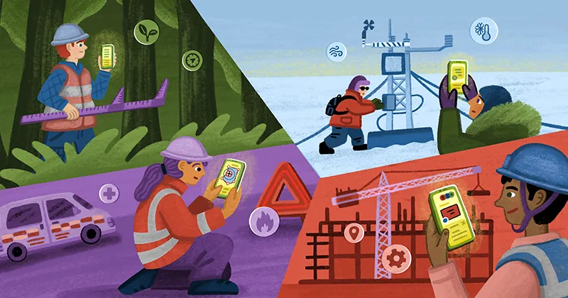
Field data collection is still a fragmented process. Someone drives to a site, takes notes on paper, and texts photos to the office. Then someone else spends the time re-entering that data, matching photos to locations, and chasing down details before anyone can make a decision or move the project forward.
It's slow, it's error-prone, and it hasn't meaningfully changed in years because the tools built to fix it created their own problems. Legacy field collection apps take days to configure, cost thousands per user per year, require dedicated GIS staff to maintain, and still leave field and office teams working in disconnected systems.
We built Field App to replace that entire cycle.
One connected workflow from field to office
Field App is Felt's native mobile app for iOS and Android. It turns any phone into a complete data collection tool with structured surveys, geotagged photos, GPS-based collection, and syncs everything to your organization's maps, dashboards, and apps the moment it's captured. No data entry back at the office, no reconciling records after the fact, or separate systems to manage data collected in the field.
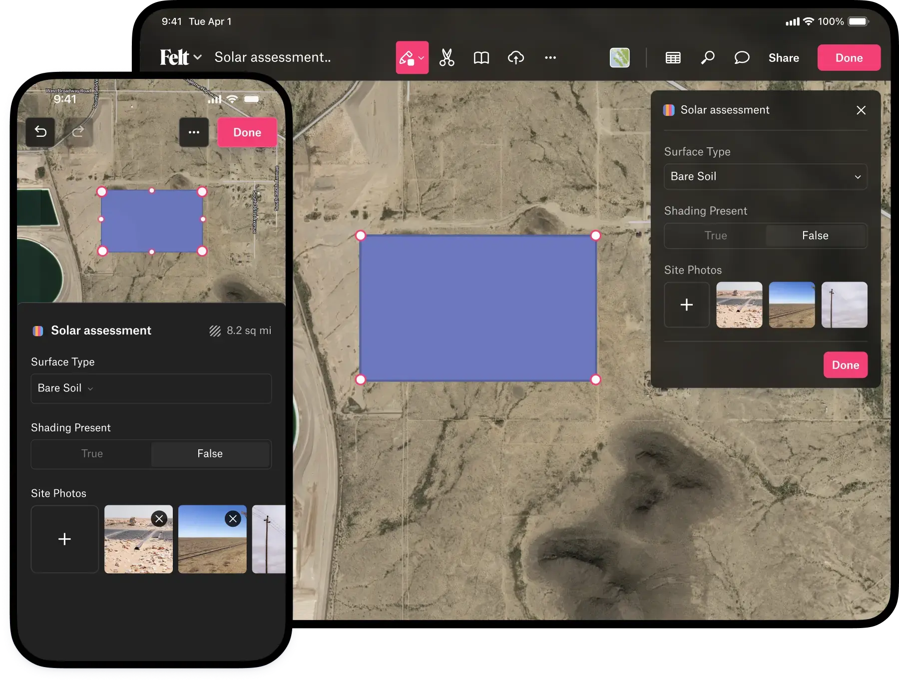
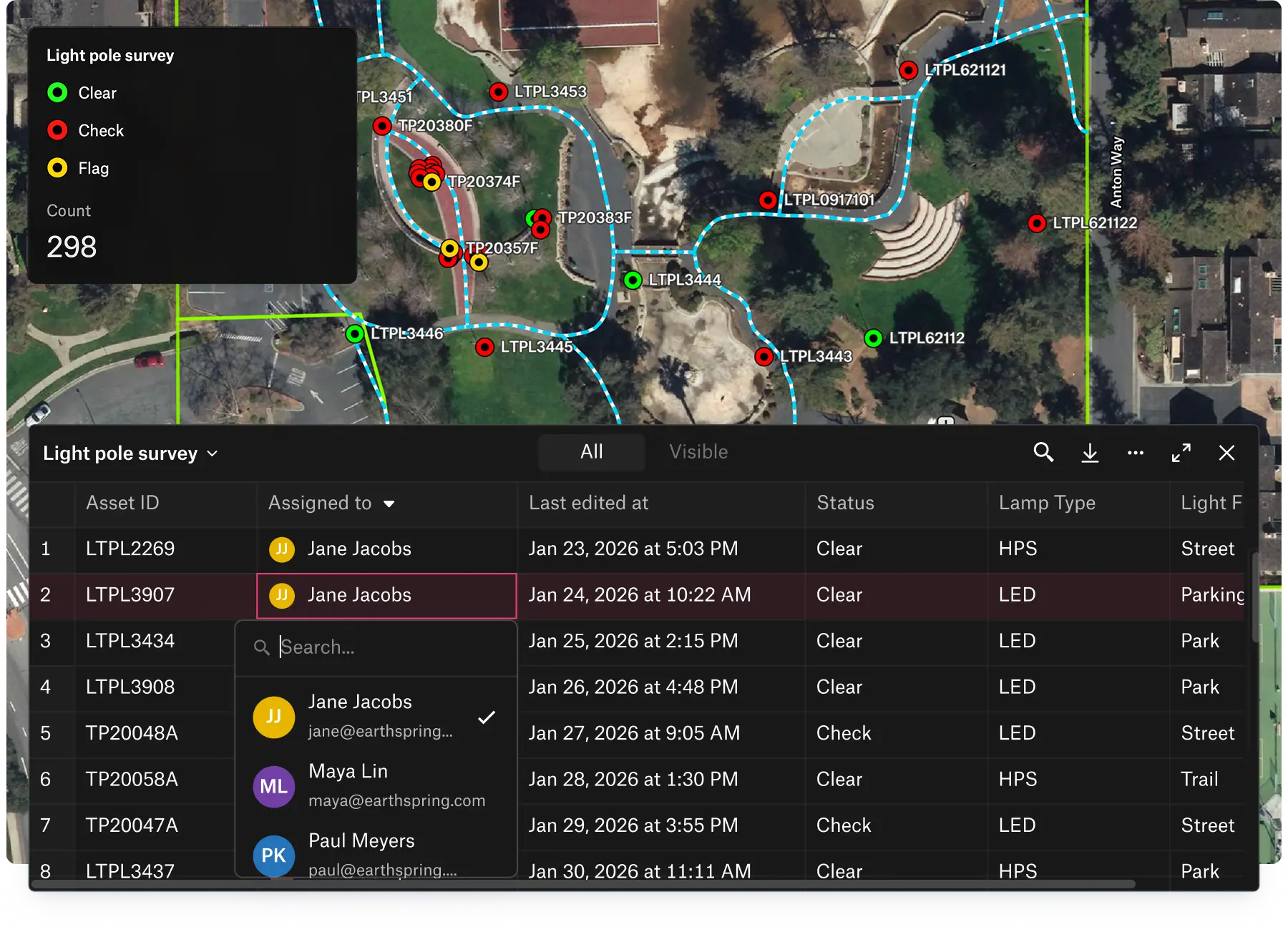
In practice, this means an admin creates a survey in a few minutes, shares the map with their field crew, and those crews are collecting structured data from their phones immediately. Every record collected shows up in the office in real time, so when a field tech drops a point and attaches a photo, the project manager can act on it instantly.
Set up in minutes, not days
Anyone who's configured a field collection app knows the drill: permissions, portal settings, feature services, sync settings, and the hope that it all holds together when multiple devices are in the field at once. Setup alone can take days, and that's even before you train the field crew.
Field App skips all of it.
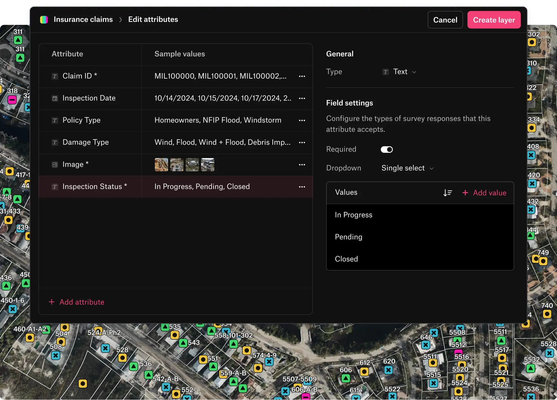
- Configure surveys in minutes. Admins create a survey by adding fields to a layer, choosing from text, numbers, single-select options, photos, dates, and person assignments, then share the map. Field crews download the app, log in, and start collecting. The mobile interface is intuitive, so crews are productive from day one without training.
- Surveys stay fully editable at all times. Unlike legacy tools that lock your schema the moment you deploy it, Felt lets you modify fields, add new pick list options, or reorder questions mid-project, even while crews are actively collecting. Changes take effect immediately, data already collected stays intact, and there's nothing to migrate, redeploy, or coordinate across devices.
Your entire team, always in sync
The biggest hidden cost of field data collection is the lag between what happens in the field and when the office knows about it. In most workflows, data sits on a device until someone syncs, exports, emails, or re-enters it. Decisions that depend on field conditions wait hours or days for information that was captured in minutes.
Field App eliminates that gap.
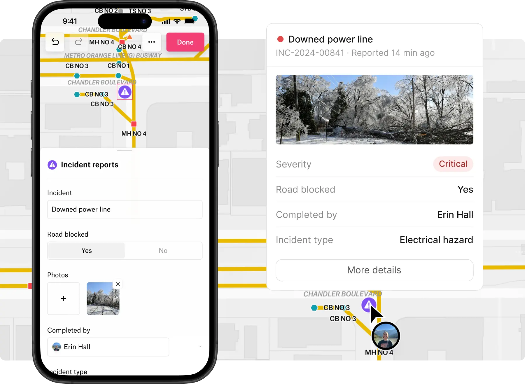
- Real-time sync. Every feature, photo, and survey response collected syncs the moment it's submitted, giving office teams real-time visibility into field operations.
- No waiting, no handoffs. Dashboards update automatically. Multiple field crews working across different sites contribute to the same map simultaneously, and nobody has to move data between systems or wait until crews get back to the office to make decisions.
Manage field operations in one system
Coordinating field crews and tracking what's been done has always meant working outside the collection tool. Who submitted this record? When? Who edited it last? What's the area of this polygon? These details are rarely complete and never consistent, so the person running the project spends as much time reconstructing what happened as they do managing what's next.
With Field App, there are no more spreadsheets, text threads, or separate project management tools to reconstruct who did what and when.
- Track assignment and scheduling with person and date fields. Assign a task to a specific crew member, set a due date for follow-up work, or log when an asset was last serviced, all as native survey fields that flow into maps, dashboards, and reports alongside everything else.
- Capture full metadata on every feature automatically. Who created it, when, who last edited it, and when, are all tied to authenticated credentials. Area and length calculate automatically from collected geometry, so admins can move straight from collection to analysis, reporting, and decision-making without manual entry or post-processing.
Built for crews, priced for how you actually work
Field data collection projects don't have ten editors. They have two or three people designing surveys and managing maps, and dozens or sometimes hundreds of people in the field filling them out. Legacy GIS tools price every seat like it's an editor, which means you're paying thousands per year for someone who just needs to drop points and take photos.
Felt's Contributor seat is purpose-built for field crews:
- Contributors can collect data, complete surveys, attach photos, take measurements, and leave comments, but they can't modify the survey design or the underlying map.
- Access is granted per map, so admins control exactly which projects each contributor can see.
- At $360 per contributor per year, it's straightforward to bring in seasonal crews, contractors, or large distributed teams without the licensing math that makes legacy tools impractical at scale.
Ready to transform your field operations?
Field App is available now on the App Store and Google Play. Reach out to our team to learn more about how Field App can transform your organization’s field-to-office workflows.
Compare Felt using AI


.webp)