37° 48' 15.7068'' N, 122° 16' 15.9996'' W
cloud-native gis has arrived
37° 48' 15.7068'' N, 122° 16' 15.9996'' W
cloud-native gis has arrived
37° 48' 15.7068'' N, 122° 16' 15.9996'' W
cloud-native gis has arrived
37° 48' 15.7068'' N, 122° 16' 15.9996'' W
cloud-native gis has arrived
37° 48' 15.7068'' N, 122° 16' 15.9996'' W
cloud-native gis has arrived
37° 48' 15.7068'' N, 122° 16' 15.9996'' W
cloud-native gis has arrived
37° 48' 15.7068'' N, 122° 16' 15.9996'' W
cloud-native gis has arrived
37° 48' 15.7068'' N, 122° 16' 15.9996'' W
cloud-native gis has arrived
37° 48' 15.7068'' N, 122° 16' 15.9996'' W
cloud-native gis has arrived
37° 48' 15.7068'' N, 122° 16' 15.9996'' W
cloud-native gis has arrived
Introducing Felt AI, your built-in team of spatial engineers Learn more
Island-like shape.
Powerful field collection, made effortless
Field App for iOS and Android gives teams a powerful mobile GIS experience to capture data, sync in real time, and stay connected in the field.
Scan to
download

Trusted by industry leaders

Streamline field data collection

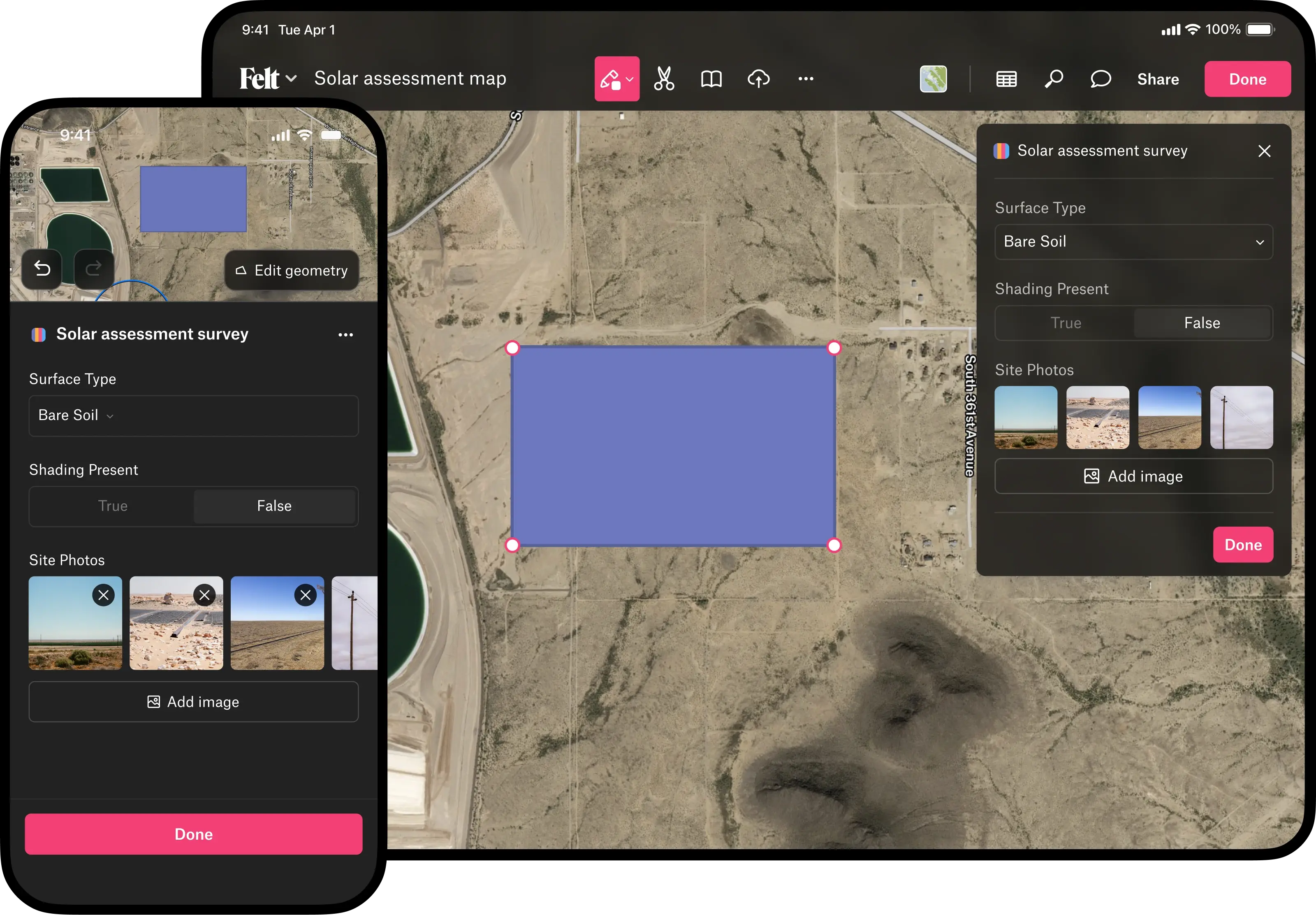
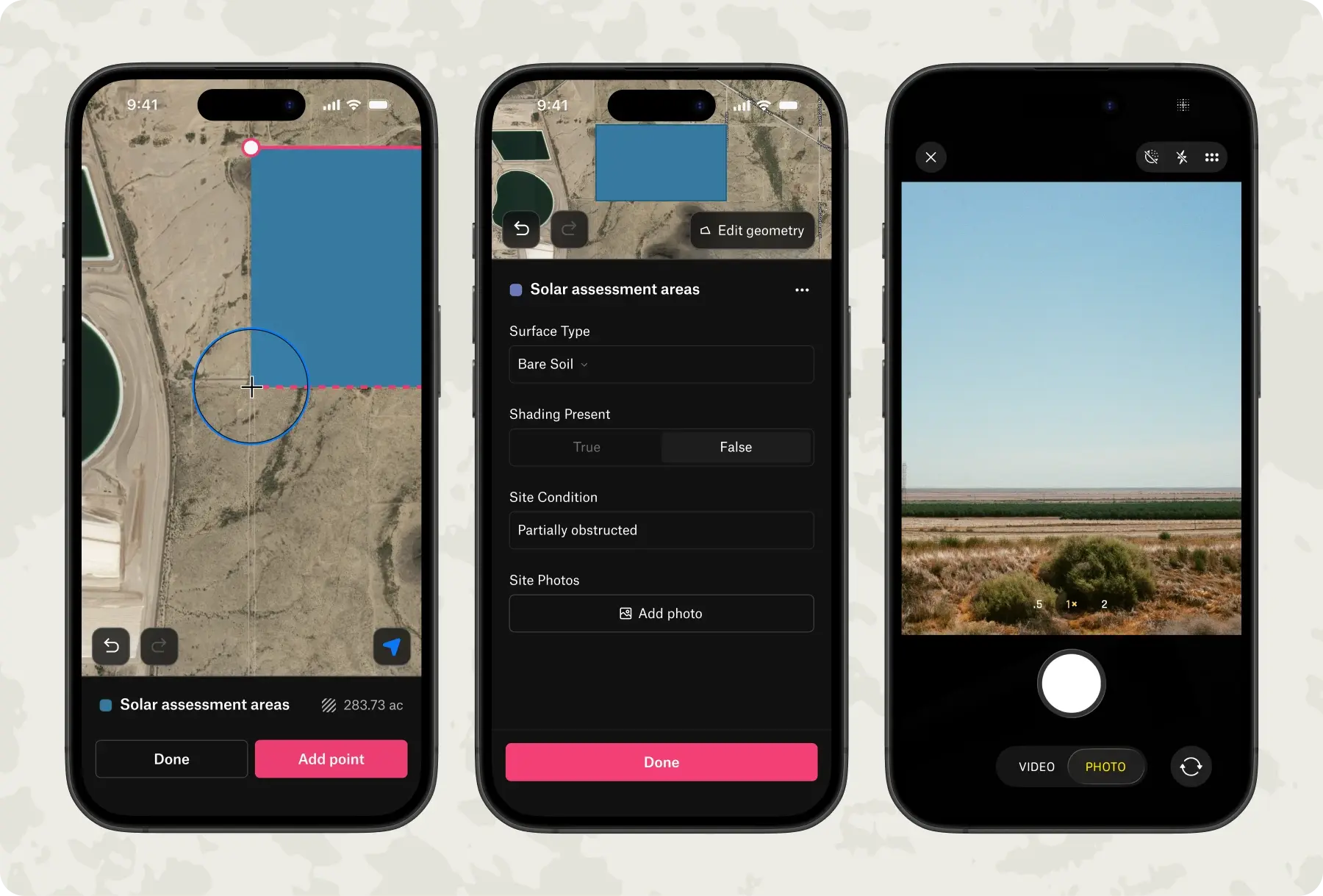
Felt's mobile app turns any device into a complete field collection tool, with no configuration or training required.

  • Create custom surveys that standardize what your team collects in the field for documenting assets, inspections, or observations
  • Capture points, lines, and areas with automatic location tracking and GPS precision
  • Add visual context by attaching geotagged photos directly to features and comments, capturing conditions exactly as they exist
  • Work offline anywhere—when you're back in range, data syncs and is ready to analyze and share

Instant field-to-office sync

Eliminate delays between fieldwork and decision-making with automatic data sync.

  • See updates across your organization the moment they're made
  • Track progress and adapt to changing conditions in real time
  • Work from a single live map across all sites

Access the full Felt platform on mobile

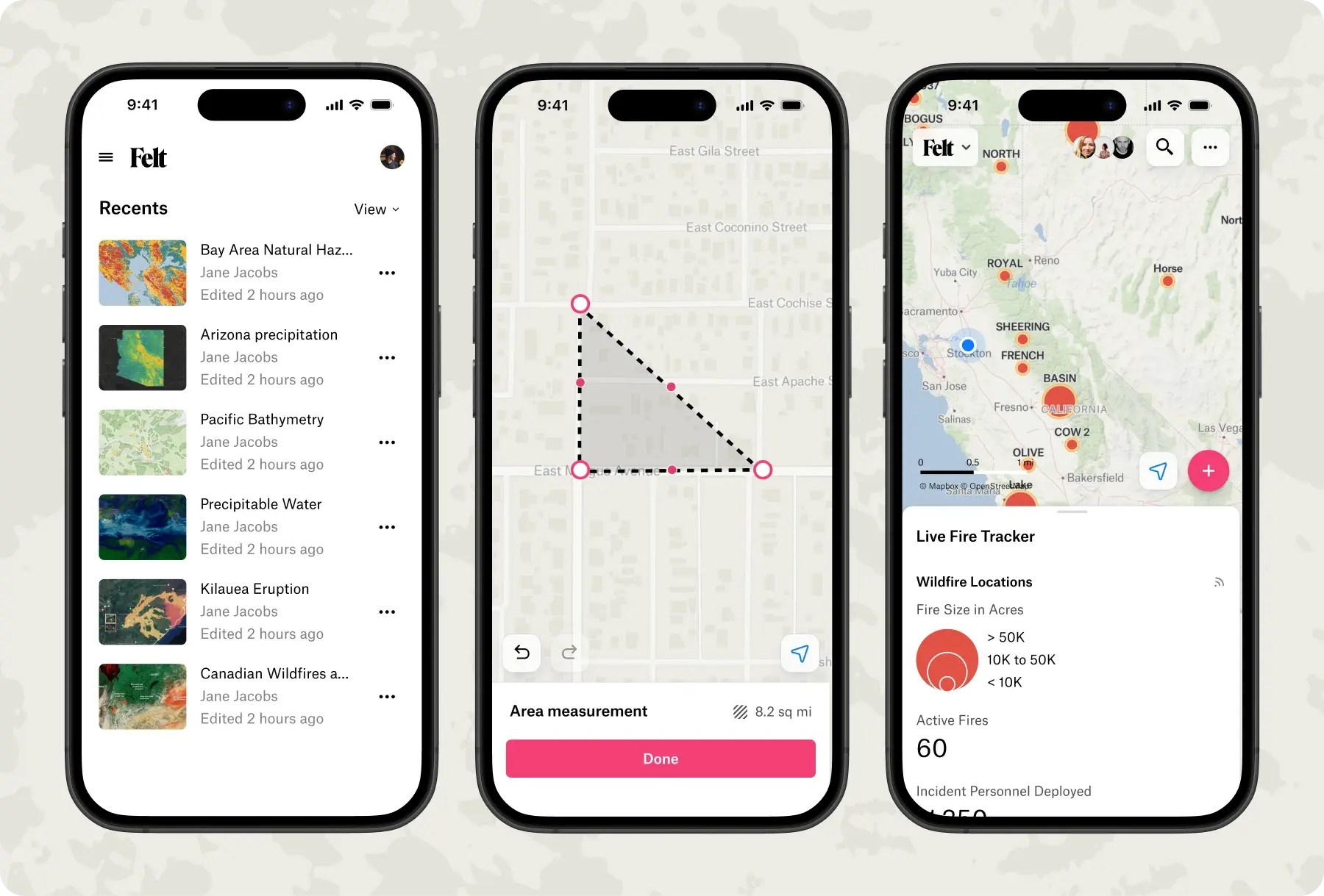
Make decisions anywhere with full GIS capabilities.

  • Access maps, dashboards, and custom apps from anywhere
  • Search, filter, and measure to validate information on site
  • Run analytics and custom workflows built with Felt AI

Keep operations moving without connectivity

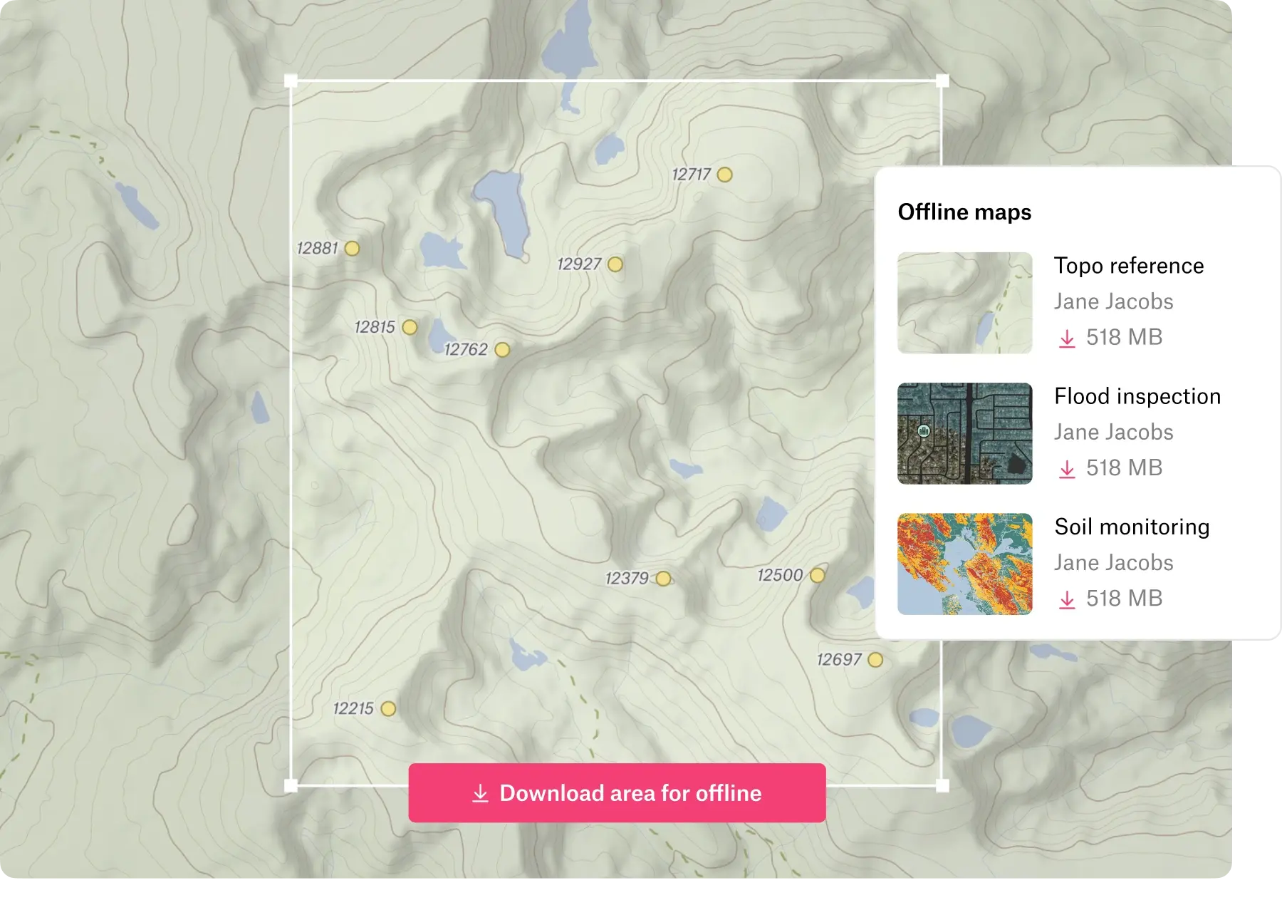
Keep field operations running regardless of network conditions with complete offline functionality.

  • Download maps for complete offline access
  • Collect and edit data with full field capabilities
  • Sync all changes automatically when back online
Book a demo
Start free trial
"For anyone needing to deliver mapping products quickly, I'd be hard-pressed to recommend anything else."
"I find Felt the quickest and easiest way to have planners and analysts visualize data."
"Felt allows us to more efficiently assess where our pickup requests come in."
Built for modern field operations
Customer Spotlight
"My favorite maps have always been the ones made in the moment, either out of necessity or on a whim."
— Tim wallace, senior editor of geography, new york times
"My favorite maps have always been the ones made in the moment, either out of necessity or on a whim."
— Tim wallace, senior editor of geography, new york times
Frequently Asked Questions

What are the benefits of mobile data collection?

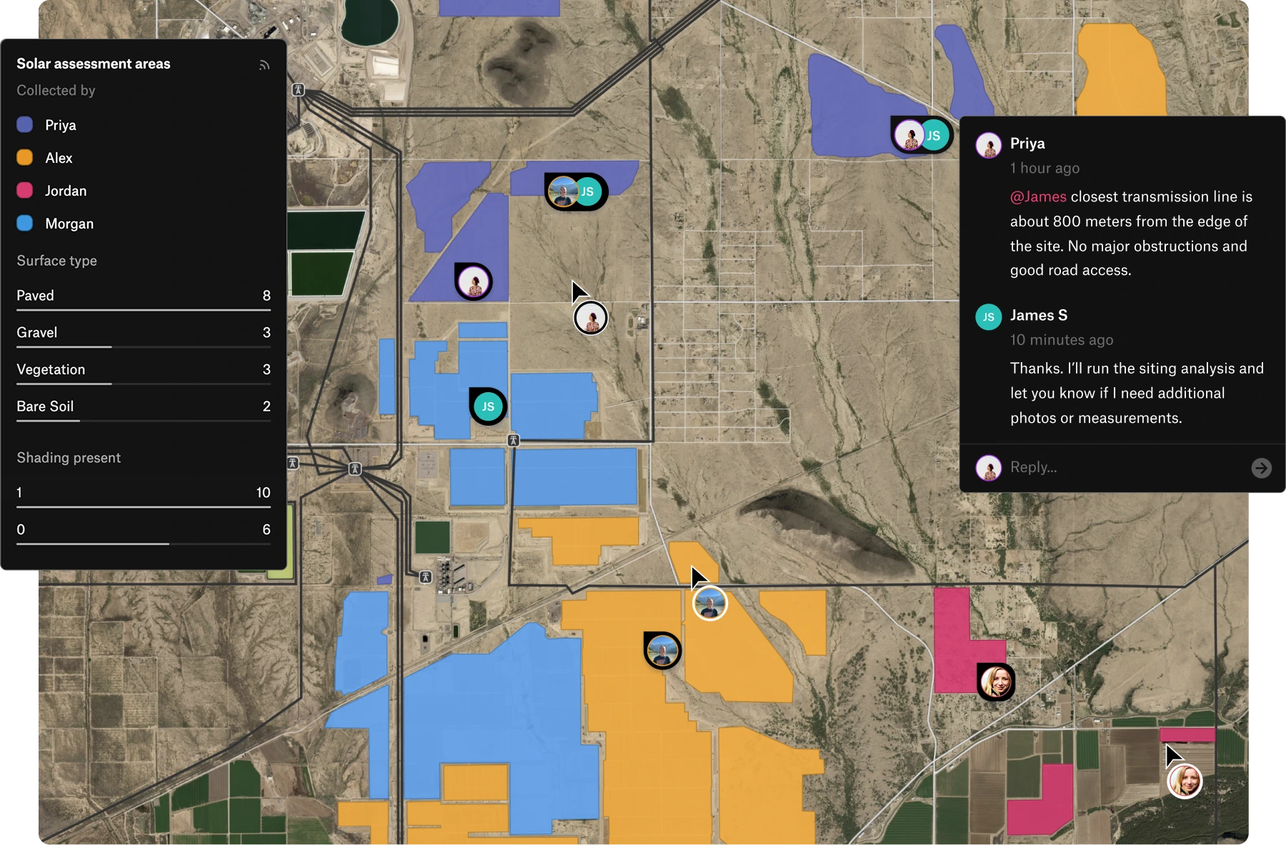
Mobile data collection lets field teams capture observations, measurements, and photos directly on their devices with GPS accuracy automatically recording precise locations. Data collection tools with offline capability work anywhere without cell coverage, syncing automatically when connectivity returns.

This approach delivers cleaner, more accurate field data collection that's immediately ready to map and analyze, while giving teams real-time visibility into operations.

What are the four most common types of data collection?

The four most common types of data collection are surveys, observations, interviews, and document review, all enhanced by modern mobile data collection. Surveys gather structured responses, observations capture real-world conditions through field data collection with high GPS accuracy, interviews collect detailed qualitative insights, and document review compiles information from existing records.

Today’s data collection tools support field data collection with built-in GPS accuracy to capture precise locations and offline capability so teams can work anywhere. These advances make it easier to gather standardized inputs, record real-time observations, and organize information without manual workflows.

What are some use case examples of field-based data collection?

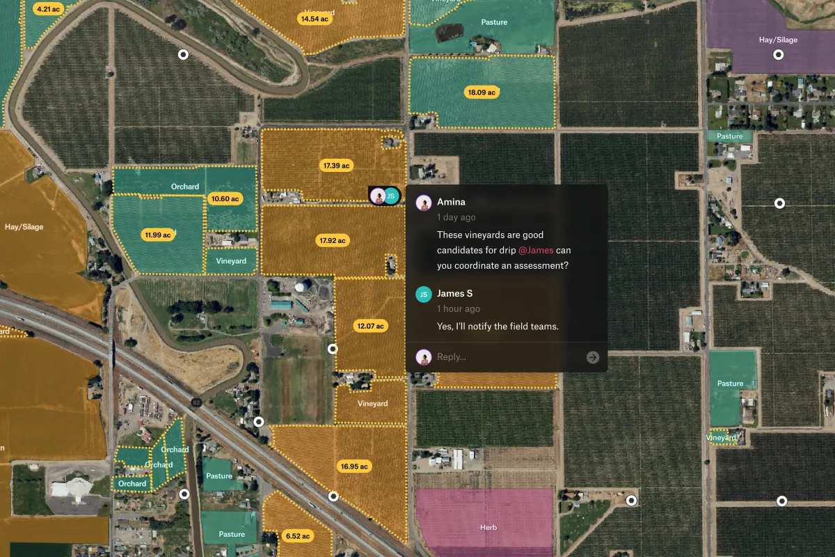
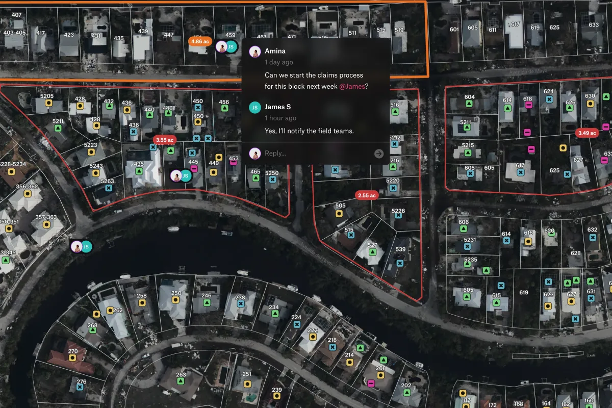
Field-based data collection is used in environmental surveys to record habitat conditions, in infrastructure inspections to document road or utility asset issues, and in public health assessments to track conditions across communities using mobile data collection tools. Emergency responders also rely on field data collection to map damage after storms or fires with high GPS accuracy, while real estate and land teams capture property details and site features in the field.

Modern data collection tools with offline capability support all these use cases by allowing teams to work reliably in remote or low-connectivity areas.

Start creating maps today