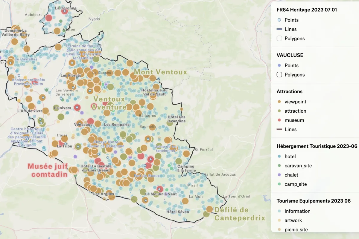
Tourism in Vaucluse, France
Jean-Louis Zimmerman used OSM and Felt to map tourist attractions of his home region of Vancluse.
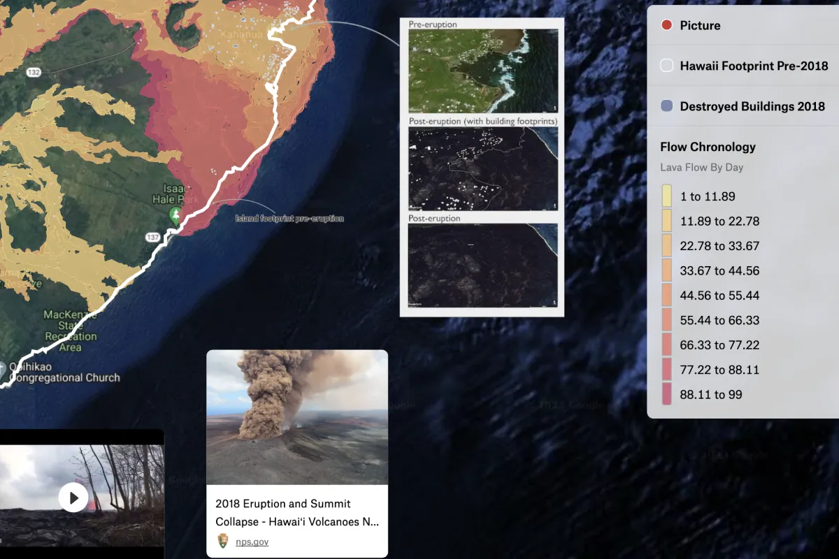
Kilauea Eruption, 2018
GIS Analyst Chris Soriano created a map showing the lava flow path of the Kilauea volcano in 2018.
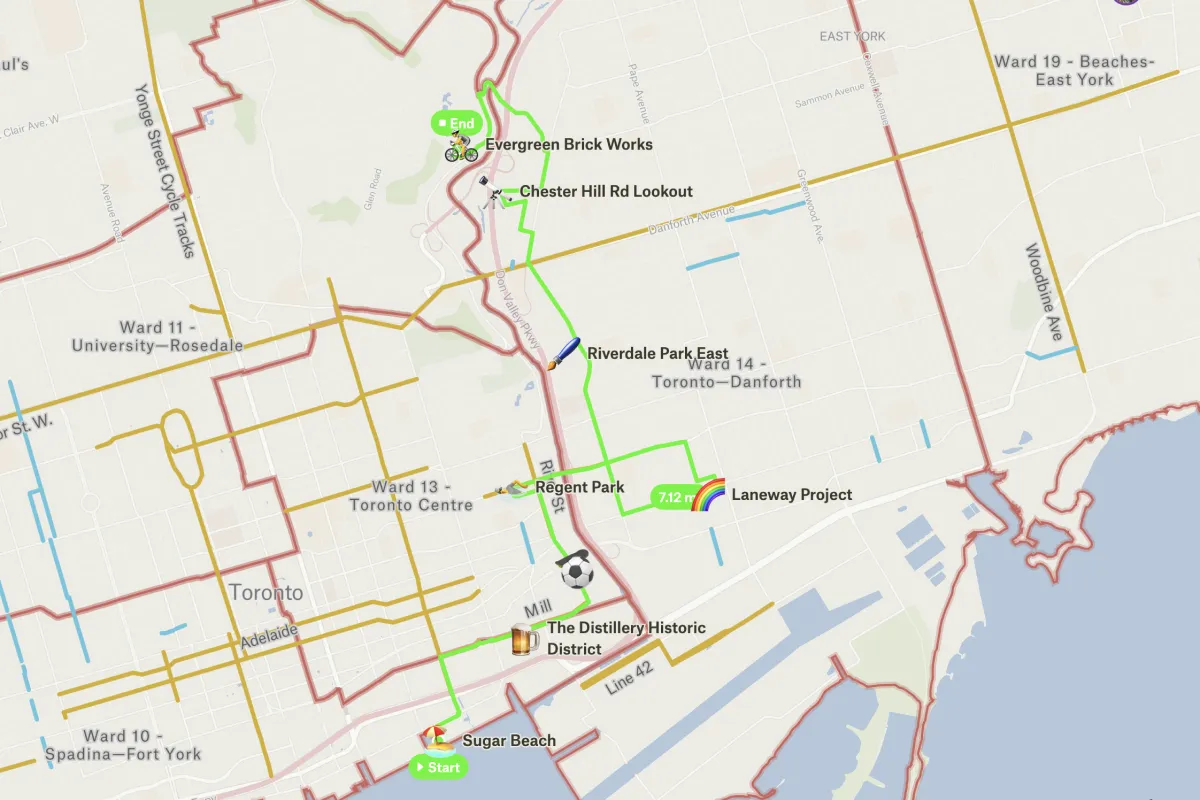
Toronto Public Realm Bike Tour
Lanrick Bennett Jr. used Felt to share a map with all the participants of a bike tour he led in Toronto.
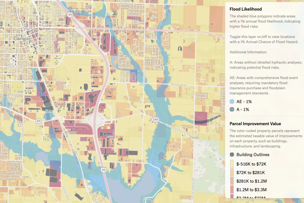
Taxable property improvement value
Kaine Robertson used Open in Felt button to bring Regrid sample data into the browser. In this Faulkner Arkansas map, he focused on visualizing taxable property improvement value. This information is valuable for insurance providers, property owners, city planners, government agencies, and property developers. It offers insights into flood risks, insurance coverage, property investments, and risk mitigation.
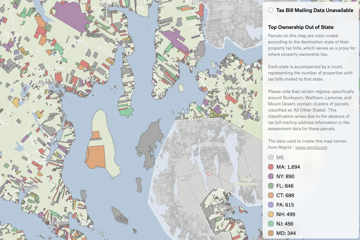
Out of state ownership in Maine
Alex Alsup, Vice President of Research & Development at Regrid, was inspired by an op-ed about saving Maine’s year-round communities and thought he'd take a look at the county he was visiting soon — Hancock, ME. Alex made a map which shows that 1 in 4 properties there are owned out of state, and owner names in the county include a lot of rather recognizable last names.
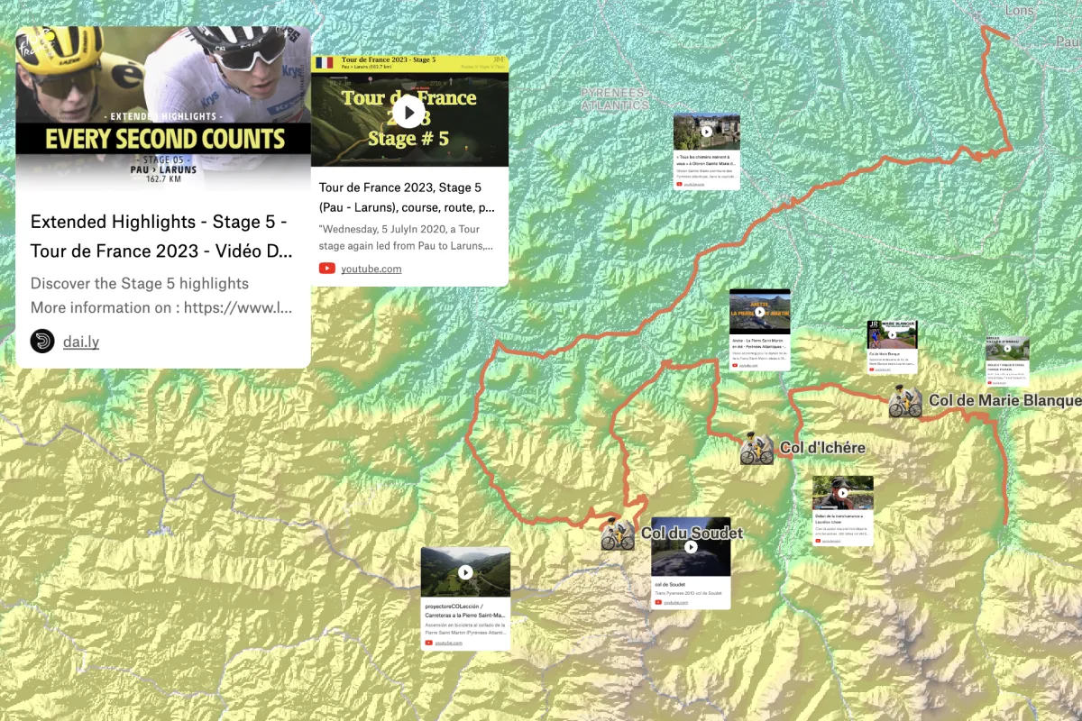
Tour de France 2023, all the stages on one map
GIS specialist Márton Leitold created a map for anyone who is following Tour de France this year.
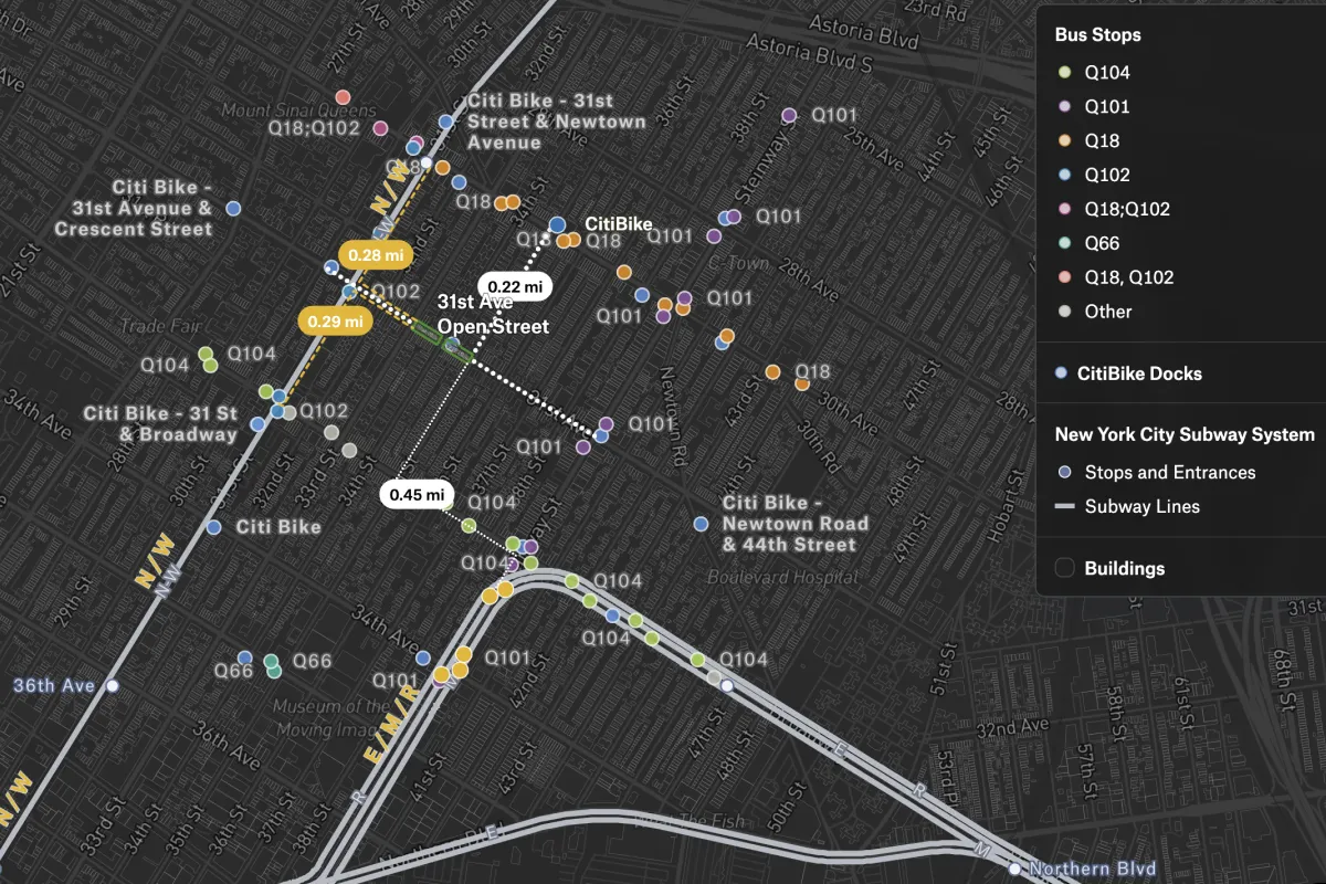
Getting To 31st Ave Open Street
Bobby Feltault mapped the nearest bike docks, train stations, and bus stops around an Open Street in Astoria, Queens, to help his neighbors navigate the area.
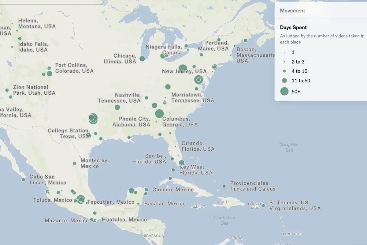
All the places visited
David Moss has taken a video every day, recording where he is for the past 10+ years (since late 2012). He was looking for a way to visualize and share this easily, but wanted something interactive he could post on his personal website. He used Felt and was able to quickly visualize his travels.
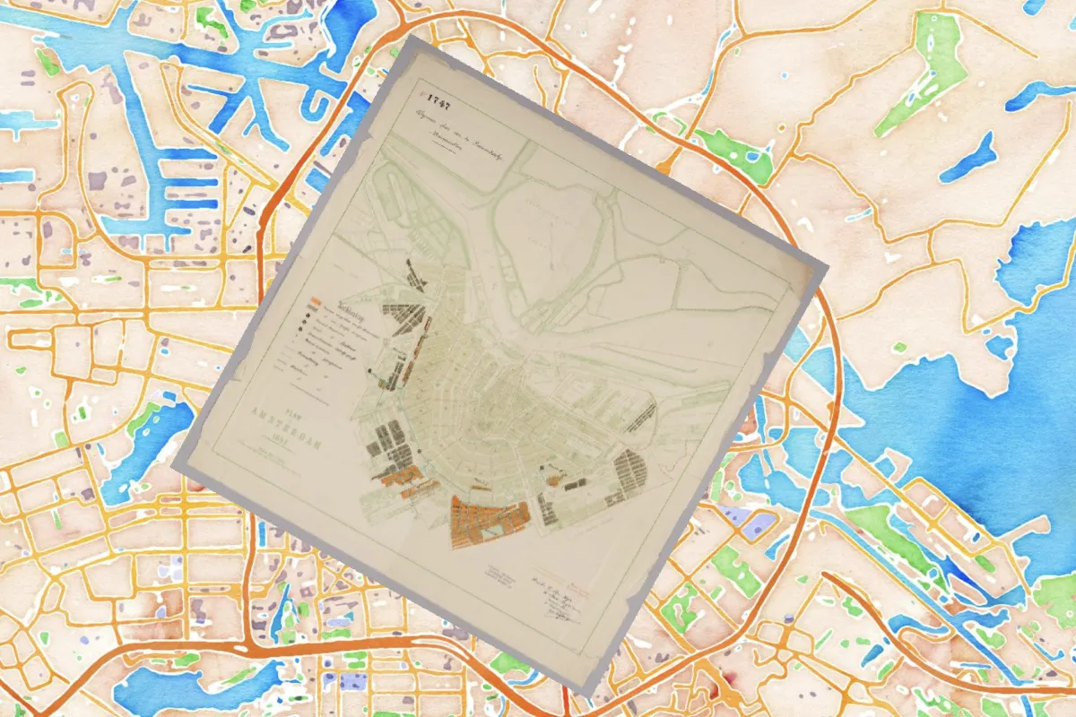
Georeferencing 1747 Plan van Amsterdam
Stace Maples used Felt, IIIF.io, and Allmaps.org to georeference 1747 Plan van Amsterdam from the Conrad Collection on Dutch Waterways and share it on a digital map.
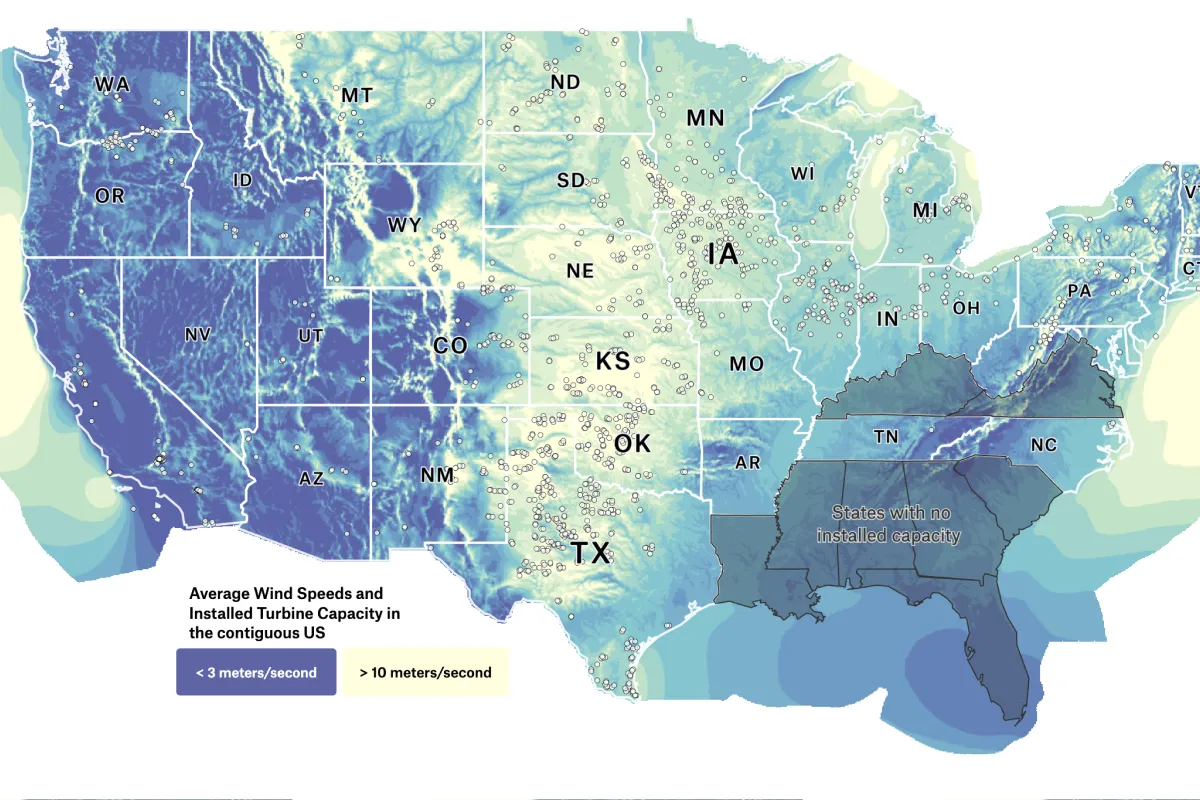
Wind speed and turbines
Felt Cartographer Mamata Akella used data from the National Renewable Energy Laboratory to map Average Wind Speeds and Installed Turbine Capacity in the contiguous US.
Want to share your map and get featured?
We recently launched our new QGIS mapping challenge — create a map using QGIS and Felt and win a limited-edition Felt drawstring bag, notebook, and a set of stickers! You map will also be featured in Felt Map Gallery.
Compare Felt using AI