9 free mapping tools to visualize real-world data
Interactive maps make complex locational data easy to understand and act on. They’re a go-to resource for countless companies, from retail businesses to environmental nonprofits. Instead of emailing static screenshots or spreadsheets, you share a link, explore the data in depth, and collaborate through real-time actions and comments.
This is possible through an intuitive geographic information system (GIS), but not every company is ready to commit their budget to these heavyweight platforms. That’s why there are so many free options. These tools let teams build maps and examine data without the learning curve and price tag of full-scale GIS software.
In this article, we’ll explore the best free mapping tools, including their standout features and pricing options, so you can confidently choose a platform for your workflow.
9 free online mapping tools for creating basic web maps
If you’re looking to create interactive maps without paying up front, consider these nine tools.
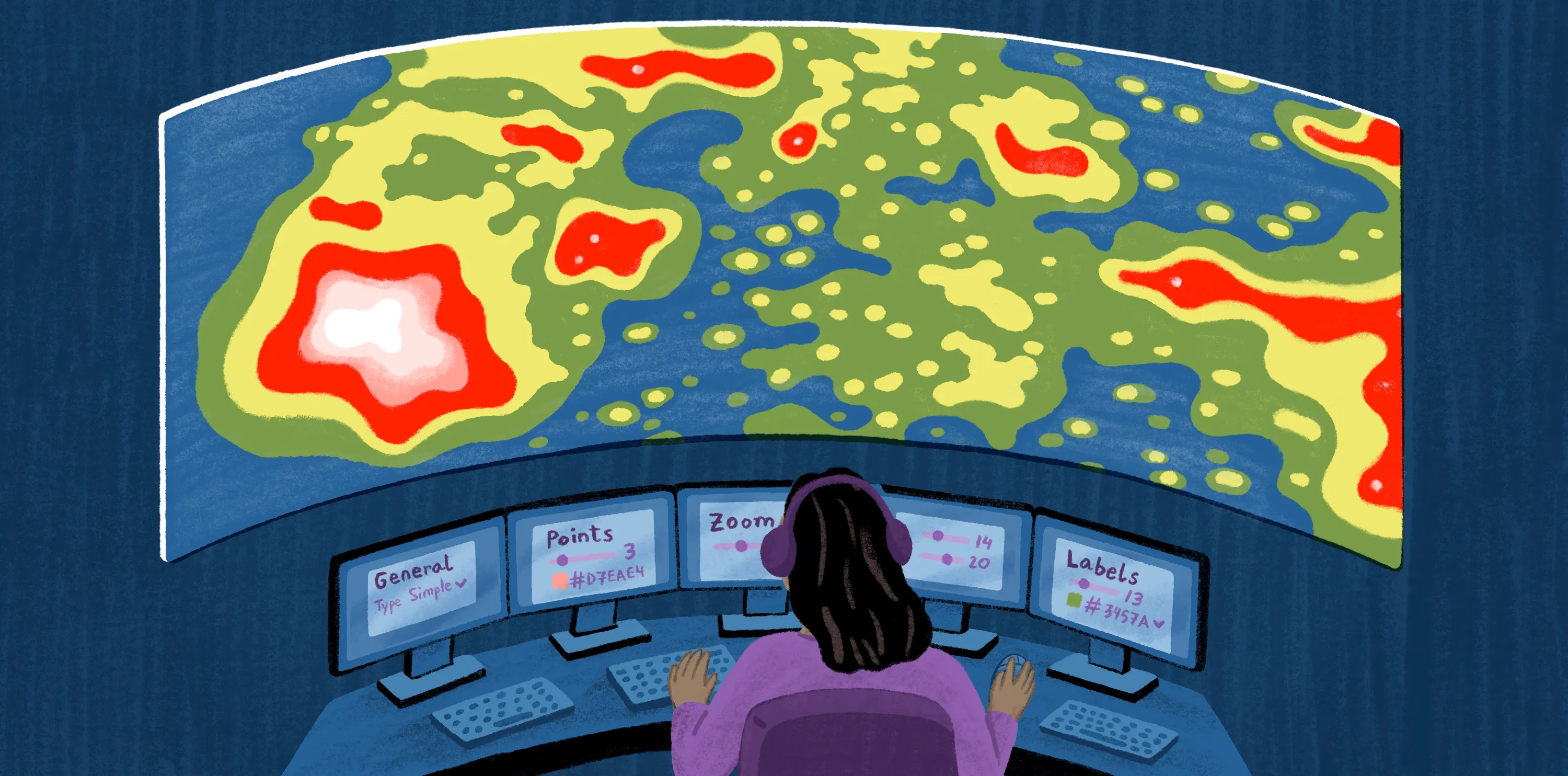
1. Felt
Felt is a cloud-native GIS. This platform lets you build interactive maps directly in your browser and share them as links — no login or installation required. Every stakeholder can jump in and explore maps in real time, regardless of tech expertise. Here are the key features in Felt’s free plan:
- Unlimited map creation: Create as many web maps as you’d like.
- Unlimited annotations: Add pins, shapes, and callouts to highlight important information.
- URL sharing: Generate and publish links so teammates can view and edit maps without back-and-forth messaging.
- Real-time collaboration: Bring teammates in, and work together with role-based access.
- In-app comments: Offer feedback directly on the map.
Best for: Fast, collaborative, teams who love to work in the cloud
Pricing: Unlimited free plan, paid plans start at $200/month
2. Google Maps
Google Maps lets you build simple maps on top of Google’s familiar interface and share them as a Google Drive file. It allows you to work with layers and icons but has a few drawbacks, like limited collaboration and performance capabilities. Here are its main free features:
- Sharing and collaboration: Invite others to view and edit maps.
- Site embedding: Publish a public map, and embed it within your website or app.
- Downloading and publishing: Export maps to KML or KMZ and layers to CSV for spreadsheets.
Best for: Teams who need lightweight web maps and prioritize sharing over in-depth analysis
Pricing: Free plan, paid plans start with a pay-as-you-go subscription plan
3. BatchGeo
BatchGeo turns spreadsheet-based location data into interactive web maps. Add spreadsheet files, and the tool geocodes and plots them on a map. It’s built on the Google Maps engine, so it has a familiar interface and visual style. Here are a few of its free functions:
- Map creation: Import spreadsheets, like Excel or CSV files, to generate maps.
- Link sharing: Generate a URL to access maps.
- Basic usage: Save maps for 90 days, access 250 geocodes a month, and view maps up to 50 times.
Best for: Simple, one-off projects, such as events or directories
Pricing: Free plan, paid plans start at $99/month
4. Esri’s ArcGIS Online
ArcGIS, created by Esri, is a web-based GIS for building and sharing interactive web maps. It lets teams store, visualize, and analyze datasets. While it offers a free version, it’s limited, lasting only 21 days. Here are the features you can access in the trial:
- Map building: Create, store, and manage maps online.
- A limited amount of credits: Access 400 credits, ArcGIS’s currency, to perform actions like analyzing and storing maps.
- Community content: Use content shared by Esri and other GIS users on the platform, such as maps and data.
Best for: Companies that don’t expect to use a free version for an extended time
Pricing: Free trial, prices range depending on number of users and their roles
5. eSpatial
eSpatial is a browser-based mapping tool. It creates interactive maps using data from spreadsheets, customer relationship management systems, and enterprise resource platforms. It’s a free-to-try option, so you’ll have to pay if you want its service long term. Here are the functions you can demo:
- Map creation: Import data and automatically plot it on a map.
- Sharing and embedding: Share maps privately or publicly, and embed them into your website.
- Route building: Design routes and measure drive times for people and vehicles.
Best for: Sales teams that want to monitor accounts and territories using their existing tech stack data
Pricing: Free trial, prices start at $1,495/per year
6. Maptive
Maptive is a browser-first mapping tool for converting spreadsheet numbers into interactive maps. Like BatchGeo, it’s built on the Google Maps engine, so it features a similar interface. It doesn’t have an officially listed free version but offers a trial that converts to a free account after 10 days. While Maptive doesn’t disclose which features are available after the trial ends, these are the features to expect at the start:
- Map creation: Upload spreadsheets and create maps.
- Route planning: Draw shapes to design territories and routes.
- Sharing and exporting: Save and share maps as PDFs.
- Limited usage: Create five maps, and access 10,000 geocodes.
Best for: Companies that only need a short window to decide whether they want the tool
Pricing: Free trial, prices start at $250/45 days
7. Mapbox
Mapbox offers location services, mapping software, and application programming interface (API) tools. This lets developers build interactive maps inside websites and apps, with a primary focus on navigation and automotive use, though it has a few limitations, like API constraints and mobile performance issues. Here are a few of its free features:
- Mapbox Studio access: Use a design tool to create custom map styles in the browser.
- Basic usage: Use any feature to a predetermined limit. If you exceed it, you’ll need to transfer to a paid model.
- Search and navigation APIs: Request limited geocoding, directions, and static tiles.
Best for: Product teams building interactive maps into customer-facing web or mobile apps
Pricing: Free plan, paid tiers start with a pay-as-you-go subscription plan
8. OpenStreetMap
OpenStreetMap (OSM) is a community-built, openly licensed database for basemaps and interactive map data. Developers use the software in various ways, such as embedding maps in websites and importing OSM data to a GIS for analysis. This tool doesn’t offer paid tiers, so here are its primary features rather than free functionality:
- Map building: Download, edit, and republish OSM maps, with attribution.
- Community editing: Access an open-source community with collaborative editing.
- Sharing and embedding: Generate a link or an embeddable HTML snippet for maps.
Best for: Small, nonprofit teams creating prototypes and community projects
Pricing: Free
9. QGIS
QGIS is a free, open-source tool for creating maps and running spatial analysis. Like ArcGIS, it’s a traditional, desktop-focused tool. You can bring this platform into the future with its seamless Felt integration. Grab files from QGIS and import them into Felt to transform them into shareable, browser-based maps. QGIS is free forever — here are its key features:
- Map creation: Build, edit, and analyze maps.
- Map exporting: Export maps as PDF/SVG/images for sharing.
- Plugin ecosystem: Extend functionality with plug-ins from the official repository.
Best for: Teams who want open-source autonomy that integrates with powerful, modern tools
Pricing: Free
How to pick the best map maker based on your needs
Here are a few factors to consider when choosing mapping services for your team:
- Map type: Review which kinds of maps the software creates. Some tools are great for quickly creating pin maps, while others are built for territories and deep analysis.
- Data inputs and limits: Check whether the tool supports the file formats you work with (some software lets you upload almost anything). It’s best to review data limitations, too, like its information processing and real-time refresh capabilities.
- Sharing and privacy controls: Review the tool for access control. If your data includes sensitive information, look for controls like private links and role-based permissions.
- Collaboration: Choose a tool that allows multiple stakeholders to view and edit maps. Map-building is easier when teammates can work together and leave helpful feedback in real time.
- Customization and API capability: Pick software that aligns with your technical level. Some teams prefer no-code tools for simplicity, while others need APIs to build detailed custom creations.
While free options are a great starting point, they may not tick every one of your boxes. For instance, data limitations may stifle teams that regularly work with large spreadsheets. It’s a good idea to determine your goals and typical workflows before committing to a single free platform, as a paid alternative could be well worth the investment.
Make maps and apps in seconds with Felt
The best GIS tools turn your data into something people can explore and understand, whether they’re teammates or customers. Interactive maps transform data into comprehensive stories and make complex cartography projects simple. When you add collaboration on top, mapping goes from a solo workflow to a shared process. That’s what Felt offers: comments, context, and convenience in one place.
Felt provides flexible workflows and smooth processes. Upload any file, visualize the data, and explore it layer by layer. Try Felt’s free forever plan, or dive into the seven-day free trial for full access to Enterprise features like custom-built dashboards and QGIS integration.
Make mapping easy with Felt.
Compare Felt using AI


.webp)