37° 48' 15.7068'' N, 122° 16' 15.9996'' W
MODERN MAP MAKING HAS ARRIVED
37° 48' 15.7068'' N, 122° 16' 15.9996'' W
MODERN MAP MAKING HAS ARRIVED
37° 48' 15.7068'' N, 122° 16' 15.9996'' W
MODERN MAP MAKING HAS ARRIVED
37° 48' 15.7068'' N, 122° 16' 15.9996'' W
MODERN MAP MAKING HAS ARRIVED
37° 48' 15.7068'' N, 122° 16' 15.9996'' W
MODERN MAP MAKING HAS ARRIVED
37° 48' 15.7068'' N, 122° 16' 15.9996'' W
MODERN MAP MAKING HAS ARRIVED
37° 48' 15.7068'' N, 122° 16' 15.9996'' W
MODERN MAP MAKING HAS ARRIVED
37° 48' 15.7068'' N, 122° 16' 15.9996'' W
MODERN MAP MAKING HAS ARRIVED
37° 48' 15.7068'' N, 122° 16' 15.9996'' W
MODERN MAP MAKING HAS ARRIVED
37° 48' 15.7068'' N, 122° 16' 15.9996'' W
MODERN MAP MAKING HAS ARRIVED
Maps
Product
Announcing Felt 2.0 — a better way to work with maps
Introducing Felt 2.0, a new chapter in our mission to make mapping effortless for everyone.

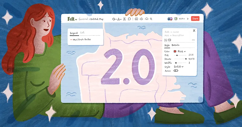
Over the past year, we've been amazed by what our users have accomplished with Felt. Teams from various industries have used Felt to align and deliver on complex projects, inspiring us to further our mission and make mapping effortless for everyone. Today, we are thrilled to introduce Felt 2.0, which includes a groundbreaking set of spatial analysis features that make data processing significantly more accessible. Alongside these new capabilities, we are also launching a redesigned Felt interface, making common workflows faster and easier.

First-of-their-kind spatial analysis tools

Every day, teams are solving problems by transforming spatial data into insights.

Here are a few examples of questions that geospatial tools can answer:

  1. Which farmlands are producing the most crops?
  2. Which buildings were most damaged by a wildfire?
  3. Which sites are best suited for power generation?

Traditionally, answering these kind of mapping questions has required complex desktop software and hours of waiting, resulting in a frustrating and slow process. With the launch of Transformations, we are revolutionizing this approach, making it easy to move quickly and confidently through your workflow. The core transformations we're launching today include Bounds, Buffer, Centroid, Clip, Count points, Dissolve, Intersect, and Subtract.

What sets this apart from other approaches is Live Previews. With Live Previews, you can see exactly what you'll get before running an analysis, eliminating guesswork. This is just the beginning of our spatial analysis tools, with many more to come.

Upload anything, visualize instantly

One of the most powerful features of Felt is its ability to instantly visualize any file format. Instead of relying on you to tell Felt about your dataset, we take care of it behind the scenes. Simply drag and drop your files onto the map, and Felt handles the rest. Here are just a few examples of supported file formats:

  • Vector Data: Shapefiles, GeoJSON, GeoPackage, Geodatabase, KML, GPX;
  • Raster Data: GeoTIFFs, GeoPackages, PNGs with World files, ASCII grids;
  • Spreadsheets: Automatically geocode addresses and join against census and EuroState data;
  • URLs: XYZ Raster Tiles, ESRI MapServer & FeatureServer, Hosted Files, WMTS, PMTiles.

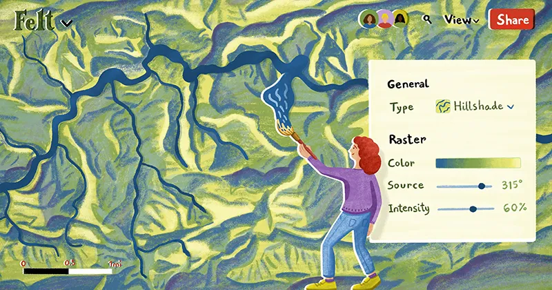
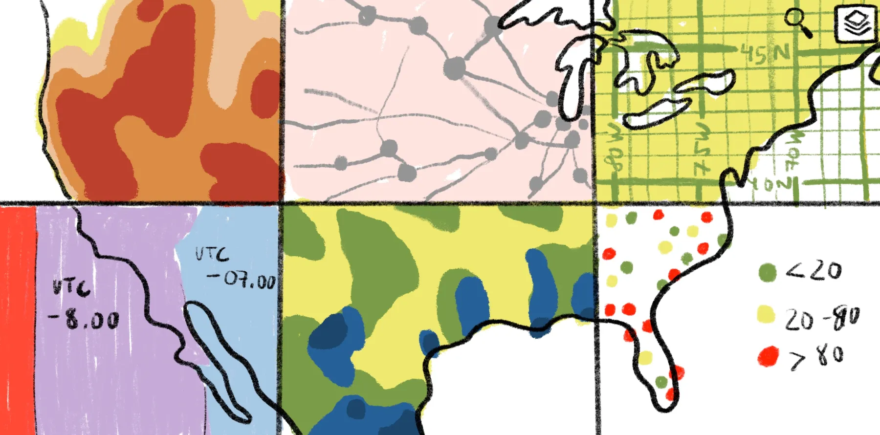
Behind the scenes, we leverage our open-source tiling engine, Tippecanoe, combined with machine learning to produce highly performant, automatically-projected versions of your data. Our in-house rendering engine, built on top of MapLibre, allows you to easily style vector and raster data with just a few clicks, achieving high-quality visualizations with solid cartographic defaults. Visualizations styles include categorical, choropleths, heat maps, size-by, hillshades, and dynamic raster styling.

A perfect companion to QGIS

We consistently hear from our customers that they love using Felt for sharing QGIS maps with their teams. The ‘Add to Felt’ QGIS plugin allows you to seamlessly share your maps from QGIS on the web without worrying about hosting or formats.

‘Add to Felt’ eliminates the need for creating and sharing PDFs to gather feedback — clients and colleagues can comment directly on the map. You have full control over who can access your maps, thanks to detailed permission controls. Additionally, you can embed maps in other websites or share them with a single link.

We are proud to be the first and only QGIS Flagship Sponsor, as we believe that by working together, we can inspire a new generation of map makers.

Instead of sharing 10 different plans, with one link we can communicate different ideas and approaches to our clients to collaboratively reach the best solution for the project. - Alex Painting, Consultant

Make maps part of your day-to-day operations

Whether it's for sales territories, consulting projects, long-range plans, journalism, or emergency response, maps are often the first and last thing teams look at each day. With collaboration built in from the ground up, Felt has become an essential tool for teams to align on their day-to-day ops.

Felt provides core features that enable a seamless flow between stakeholders:

  • Multi-player: Collaborate with your team in real-time, similar to Google Docs or Figma;
  • Comments: Get feedback within the context of the map, without the need for clunky PDFs or scattered email chains;
  • Data Creation: Easily draw polygons, circles, routes, and other shapes — it's as intuitive as whiteboarding;
  • API: Our extensive API allows you to integrate Felt into automated workflows, producing daily maps and auto-posting them into your favorite channels;
  • Data Library: Save and reuse datasets in the library, acting as a central source of truth for your team.

Security from the start with SOC2

From the outset, we have taken comprehensive measures to achieve SOC 2 compliance, guaranteeing top-tier data protection for all our users. Our commitment to data security, privacy, and compliance is reflected in our practices, which encompass encrypting your data, housing our servers in the United States, providing secure authentication methods, and enforcing stringent security protocols for controlling customer data access, among numerous other safeguards.

Give Felt 2.0 a try today

Experience the power of Felt 2.0 and its groundbreaking spatial analysis tools, seamless data visualization, and powerful collaboration features. You can jump in for free or learn more by booking a demo with our sales team. Join us as we continue to make mapping effortless for everyone.

Our team has completely replaced PDFs with Felt maps for construction planning — we get more fruitful project feedback and clients love it. - Jean-Eudes Comeau, Project Manager
Bio
LinkedIn
More articles

Cartography Tips for Designing Web Maps

Search, filter, select — data discovery done right

Getting the most out of Felt’s new Workspaces

Teaching Spatial Analysis with Felt

Powerful new admin tools and a streamlined billing experience

Three key UI upgrades in Felt 2.0